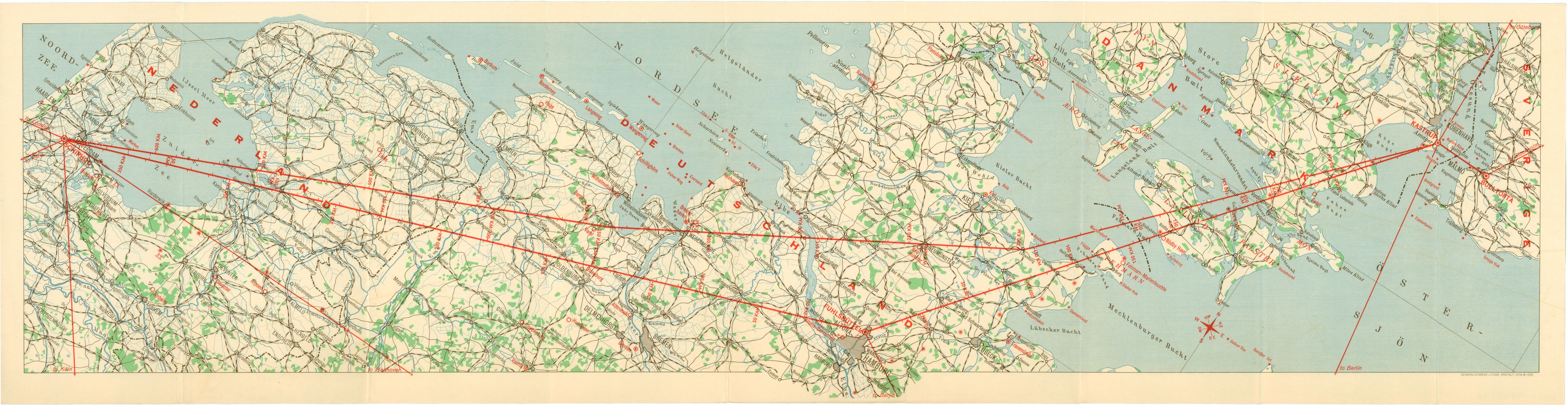
The Netherlands-Denmark Route map/Strip_map, 1935

This map was made in 1935 by the Swedish map producer Generalstabens Litografiska Anstalt, GLA (~ General Staff's Lithographic Institution). It has been scanned in USA by National Air and Space Museum, Smithsonian institution, Washington. They are preparing an exhibition for 2013 on Time and Navigation, and has a website with lots of maps, see link below.

The map covers the air route
Amsterdam/Schiphol -
- Copenhagen/Kastrup.
The image is very wide, so you have to scroll sideways - with arrow-keys or the scroll-bar:
   

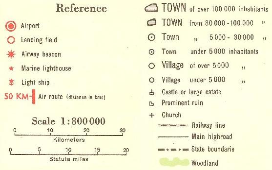
In the western part of the map, one can see a row of red star symbols for air light beacons from Amsterdam/ Holland into Germany, › see my webpage

A similar row of beacons can be seen from Hamburg and up through Denmark, › see my webpage

However, the main route on the map is the direct route between Schiphol and Kastrup. Hence, this map may have been intended for flights in daylight.

References:


Updated: 2 May, 2012, Bo Justussson, Stockholm
Contact: justusXownit.nu - switch X to @