• AA System Overview Map with nice drawings.
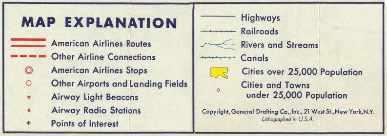
Navigation was made with Radio beacons (6-stars in maps) and Light beacons (5-stars in maps).
- Radio beacons at airports, and at long legs also some inbetween. Light beacons much closer to each other.
Source: • David Rumsey Historical Map Collection
Link to their excellent scanning: • AAR Map - zoom in!
Click on maps and texts below for larger images!
| 1.Boston- New York |
2.Chicago- Buffalo |
3.Buffalo- New York |
4.Chicago- St.Louis |
5.St.Louis- Ft.Worth |
6.Chicago- Washington |
7.Boston- Cleveland |
8.Cleveland- Nashville |
9.Albany- New York |
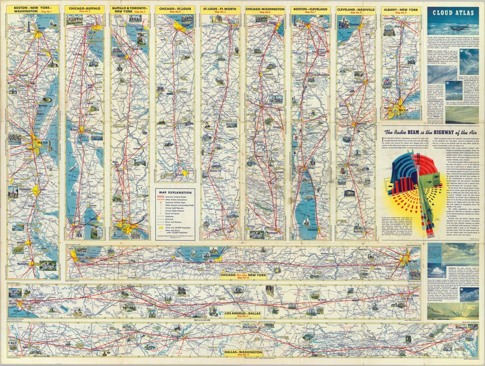
| 10.Chicago - New York | 11.Los Angeles - Dallas | 12.Dallas - Washington |